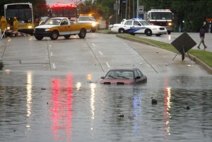
Another Katrina anniversary. Another storm. This one, thank heaven, a dwarf in destructive power compared with its infamous predecessor.
Even as a relatively weak Category One hurricane, however, Isaac is proving to be troublesome. Some of the most destructive storms to hit the Gulf Coast have been low-velocity but slow-moving storms, such as this one, which cling to an area for days, dumping tens of inches of rain. Already, Isaac has disrupted power to nearly half a million residents in the Greater New Orleans area. The improved Corps of Engineers flood protection system seems to be working well thus far, with only one minor glitch concerning pumping facility controls at the Seventeenth Street Canal, near the border between Orleans and Jefferson Parishes, which has been corrected. Down south, in Plaquemines Parish, near where the storm made landfall, a stretch of parish-built levees have been overtopped, not breached, and the entry of water on the east bank of the Mississippi has flooded an undetermined number of homes with up to nine feet of flooding.
Until three years ago, my family and I lived in a house on the West Bank of the Mississippi, in a suburban portion of New Orleans called Algiers. That area of the city lucked out during Katrina, not being in the East Bank flood zone. However, had Katrina made landfall fifteen or twenty miles west of where it landed, the West Bank’s levee system, then (and most likely still) greatly inferior to the East Bank’s, would likely have crumbled before the force of the storm surge, and my neighborhood would have been underwater. A flood map from The Times Picayune showed the severity of potential flooding on the West Bank, neighborhood by neighborhood. My block could have received up to nine feet of water. My house stood about four feet above the level of the street, on a slightly raised lot, so we could have returned home from South Florida, where we had taken shelter, to find five feet of water in our house.
My mother-in-law and cousins still live in Algiers. Dara and I have many friends in the New Orleans area. Many of them are without power at this point, and Isaac will stay in the area for another full day, continuing to dump rain and lash the city with wind gusts of up to a hundred miles per hour. Please keep the good folks of the Gulf Coast in your thoughts.
Here’s the beginning of an article I posted one year ago today:
“Six years ago, on another Monday, August 29th, Hurricane Katrina, a Category Three storm pushing a Category Five storm surge, slammed into coastal Mississippi. For the first twelve hours after landfall, the city of New Orleans appeared to have avoided the worst. But then the levees designed to hold back Lake Pontchartrain began breaking — the Industrial Canal levee, the 17th Street Canal levee between Metairie and the western parts of New Orleans, the London Avenue Canal levee adjacent to the Gentilly neighborhood, and the Mississippi River-Gulf Outlet levees that had been meant to protect Chalmette and St. Bernard Parish. Within a day, eighty percent of the City of New Orleans had flooded, and nearly all of St. Bernard Parish was underwater. At least 1,836 people died along the Gulf Coast, most from the flooding, making Katrina the deadliest storm in U.S. history since the 1928 Lake Okeechobee Hurricane in South Florida, when approximately 2,500 people were killed.”
Following Katrina, I worked to rebuild the devastated Lousiana Commodity Supplemental Food Program, which lost three of four food warehouses and three-quarters of its vehicles in the storm and the post-storm flooding. I then worked two-and-a-half years with FEMA, part of a management team hired to introduce some program management vigor to the problem-plagued Temporary Housing Program.
I believe it was just a month or two ago that I read that the last FEMA trailer in Southeastern Louisiana had finally been vacated. And now they may have to start in all over again, at least with some folks down in Plaquemines Parish.


